Dutch Empire/Maps and Pictures of the Dutch Empire
Jump to navigation
Jump to search

The Dutch Empire and various places under their control at different points in history.

Here are a list of maps, showing the rise and fall of the Dutch Empire. Currently, Aruba, Bonaire, Curaco, Saba and Sint Eustatius are part of the Kingdom of the Netherlands. They are all small islands in the Caribbean. I do not have a map between 1830-1938 because the only major event(s) that took place was the expansion in the East Indies, which can be seen by looking at Expansion in the East Indies section.

Maps
[edit | edit source]| This page may contain original research or unverifiable material. You can help verify material by citing reliable sources, or by asking for assistance in the project reading room. You can participate at Wikiversity if you wish to publish new research or material that has not been verified by reliable sources yet. |
-
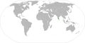
 The Dutch Empire in 1630
 -
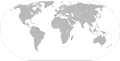
 The Dutch Empire in 1650
 -
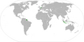
 The Dutch Empire in 1674
 -
 The Dutch Empire in 1700
 -
 The Dutch Empire in 1750
 -
 The Dutch Empire in 1795
 -
 The Dutch Empire in 1830.
 -
 The Dutch Empire prior to WWII.
 -
 The Dutch Empire in 1960.
 -
 The Dutch Empire in 1975.
 -
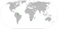
 Dutch Islands in the Caribbean today.


People
[edit | edit source]-
 William of Orange or William "the Silent", father of the Netherlands, age 47. c. 1580
 -
 William the Silent at age 22.
 -
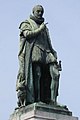 Statue of William the Silent in the Hague
 -
 Maurice of Nassau son of William the Silent.
 -
 Willam Barentsz, explorer.
 -
 Willam Janszoon, discovered Australia.
 -
 Michiel de Ruyter Dutch Navy legend.
 -
 Maarten Tromp, Dutch Navy legend.
 -
 Piet Hein, Dutch Navy legend.
 -
 Peter Stuyvesant, Director-General of New Netherland.
 -
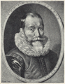
 Johan de Witt, Dutch politician.
 -
 William V, last stadtholder of the Dutch Republic.
 -
 Louis Bonaparte, King of Holland.
 -
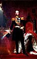
 King William I.
 -
 King William II.
 -
 King William III.
 -
 Queen Wilhelmina, and future Queen Juliana.
 -
 Queen Beatrix, current Queen of the Netherlands.


_Stuyvesant_portrait_c1660.jpg)


Flags
[edit | edit source]-
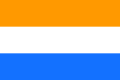 Flag of the Dutch Republic. 1581-1795
 -
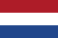 Current Flag of the Netherlands. 1806–Present
 -
 Flag of the VOC.1602-1800
 -
 Flag of the Batavian Republic.1795-1806


Legacy
[edit | edit source]-
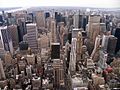 "New Amsterdam", present day New York City.
 -
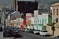 Dutch Houses in Cape Town, South Africa.
 -
 Fort Zeelandia in Suriname.
 -
 Jakarta, formerly Batavia in Indonesia.


