Template:Location map USA/doc
Jump to navigation
Jump to search


| This is a documentation subpage for Template:Location map USA It contains usage information, categories and other content that is not part of the original template page. |
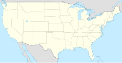
Template:Location map USA is a location map definition used to overlay markers and labels on an equirectangular projection map of the United States. The markers are placed by latitude and longitude coordinates on the default map or a similar map image.
Usage
[edit source]These definitions are used by the following templates when invoked with parameter "USA":
{{Location map|USA |...}}{{Location map+|USA |...}}{{Location map~|USA |...}}
Map definition
[edit source]- name
- used in default map caption (United States)
- image
- the default map image, without "Image:" or "File:" (USA location map.svg)
- top
- latitude at top edge of map, in decimal degrees (49.8)
- bottom
- latitude at bottom edge of map, in decimal degrees (24.2)
- left
- longitude at left edge of map, in decimal degrees (-125.5)
- right
- longitude at right edge of map, in decimal degrees (-66.5)
Examples
[edit source]Location map
[edit source]
Washington, D.C.
Washington, D.C. (United States)
{{Location map | USA
| width = 250
| lat   = 38.895
| long  = -77.037
| label = Washington, D.C.
}}
Location map+
[edit source]Washington, D.C.
Seattle
Two locations in the USA
{{Location map+ | USA
| caption = Two locations in the USA
| width   = 250
| places  =
  {{Location map~ | USA
  | lat   = 38.89
  | long  = -77.04
  | label = Washington, D.C.
  }}
  {{Location map~ | USA
  | lat   = 47.61
  | long  = -122.33
  | label = Seattle
  }}
}}
See also
[edit source]- Template:Location map USA relief, displays a relief map (for infoboxes that do not support alternative maps)
- Template:Location map USA2, uses a different map with different edge coordinates
- Location map templates
- Template:Location map, displays one mark using latitude and longitude
- Template:Location map+, to display unlimited number of markers and labels