File:Stanford-linear-accelerator-usgs-ortho-kaminski-5900.jpg
Jump to navigation
Jump to search
Size of this preview: 800 × 201 pixels. Other resolutions: 320 × 80 pixels | 640 × 161 pixels | 1,024 × 257 pixels | 1,280 × 321 pixels | 5,900 × 1,480 pixels.
Original file (5,900 × 1,480 pixels, file size: 1.88 MB, MIME type: image/jpeg)
|
|
This is a file from the Wikimedia Commons |
Summary
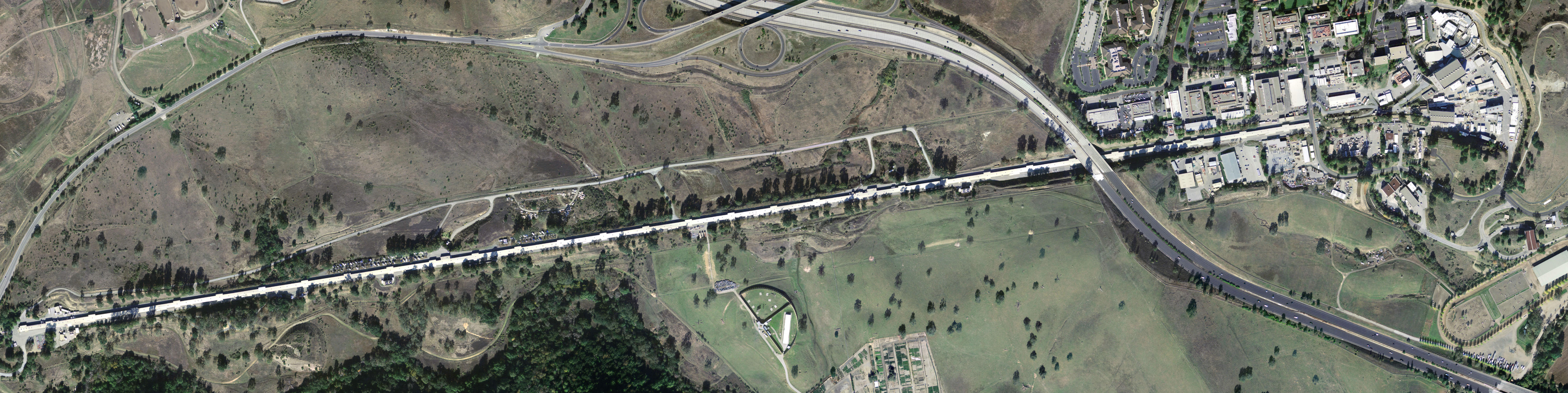
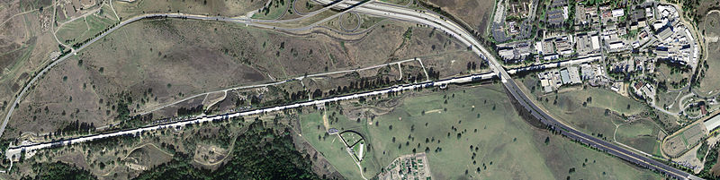
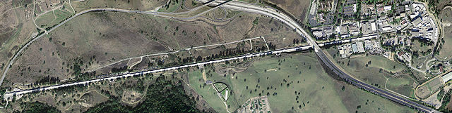
| Description | Stanford Linear Accelerator, shown in an aerial digital orthoimage. The two roads seen near the accelerator are California Interstate 280 (to the East) and Sand Hill Road (along the Northwest). |
| Date | |
| Source | United States Geological Survey |
| Author | Peter Kaminski |
Licensing
This image is in the public domain in the United States because it only contains materials that originally came from the United States Geological Survey, an agency of the United States Department of the Interior. For more information, see the official USGS copyright policy.
|
File history
Click on a date/time to view the file as it appeared at that time.
| Date/Time | Thumbnail | Dimensions | User | Comment | |
|---|---|---|---|---|---|
| current | 07:56, 8 May 2005 | 5,900 × 1,480 (1.88 MB) | Floriang | Stanford Linear Accelerator, shown in an aerial digital orthoimage. Image data acquired 2004-02-27 by the United States Geological Survey. This image created by Peter Kaminski, 2004-12-19 and uploaded in the public domain. {{ |
File usage
The following 2 pages use this file:
Global file usage
The following other wikis use this file:
- Usage on ar.wikipedia.org
- Usage on ca.wikipedia.org
- Usage on cs.wikipedia.org
- Usage on de.wikipedia.org
- Usage on en.wikipedia.org
- SLAC National Accelerator Laboratory
- Electron scattering
- John Duncan (artist)
- List of Historic Mechanical Engineering Landmarks
- Portal talk:California
- User:Cullen328/sandbox/Stanford
- User:IndianFace/sandbox
- Portal:San Francisco Bay Area/Years/Archive
- Portal:San Francisco Bay Area/Years/53
- Timeline of the San Francisco Bay Area
- Usage on es.wikipedia.org
- Usage on fi.wikipedia.org
- Usage on fr.wikipedia.org
- Usage on hu.wikipedia.org
- Usage on it.wikipedia.org
- Usage on ja.wikipedia.org
- Usage on ko.wikipedia.org
- Usage on la.wikipedia.org
- Usage on lt.wikipedia.org
- Usage on nl.wikipedia.org
- Usage on nn.wikipedia.org
- Usage on pl.wikipedia.org
- Usage on pt.wikipedia.org
- Usage on ro.wikipedia.org
- Usage on ru.wikipedia.org
- Usage on sk.wikipedia.org
- Usage on sv.wikipedia.org
- Usage on tr.wikipedia.org
- Usage on uk.wikipedia.org
- Usage on ur.wikipedia.org