
File:Saint-Martin Island map-en.svg

Size of this PNG preview of this SVG file: 796 × 600 pixels. Other resolutions: 319 × 240 pixels | 637 × 480 pixels | 1,020 × 768 pixels | 1,280 × 964 pixels | 2,560 × 1,928 pixels | 1,102 × 830 pixels.
Original file (SVG file, nominally 1,102 × 830 pixels, file size: 866 KB)
|
|
This is a file from the Wikimedia Commons |
Summary
| Camera location | | View this and other nearby images on: OpenStreetMap |
|---|
| Description |
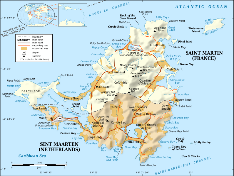
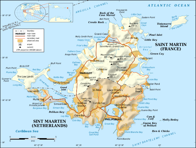
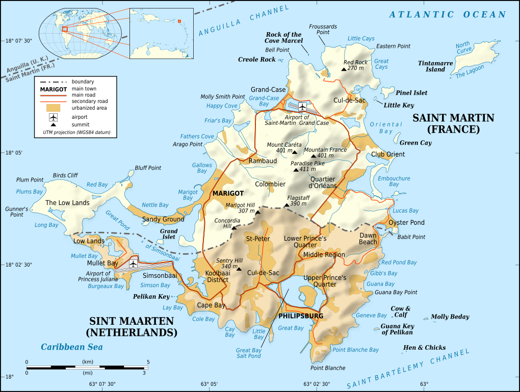
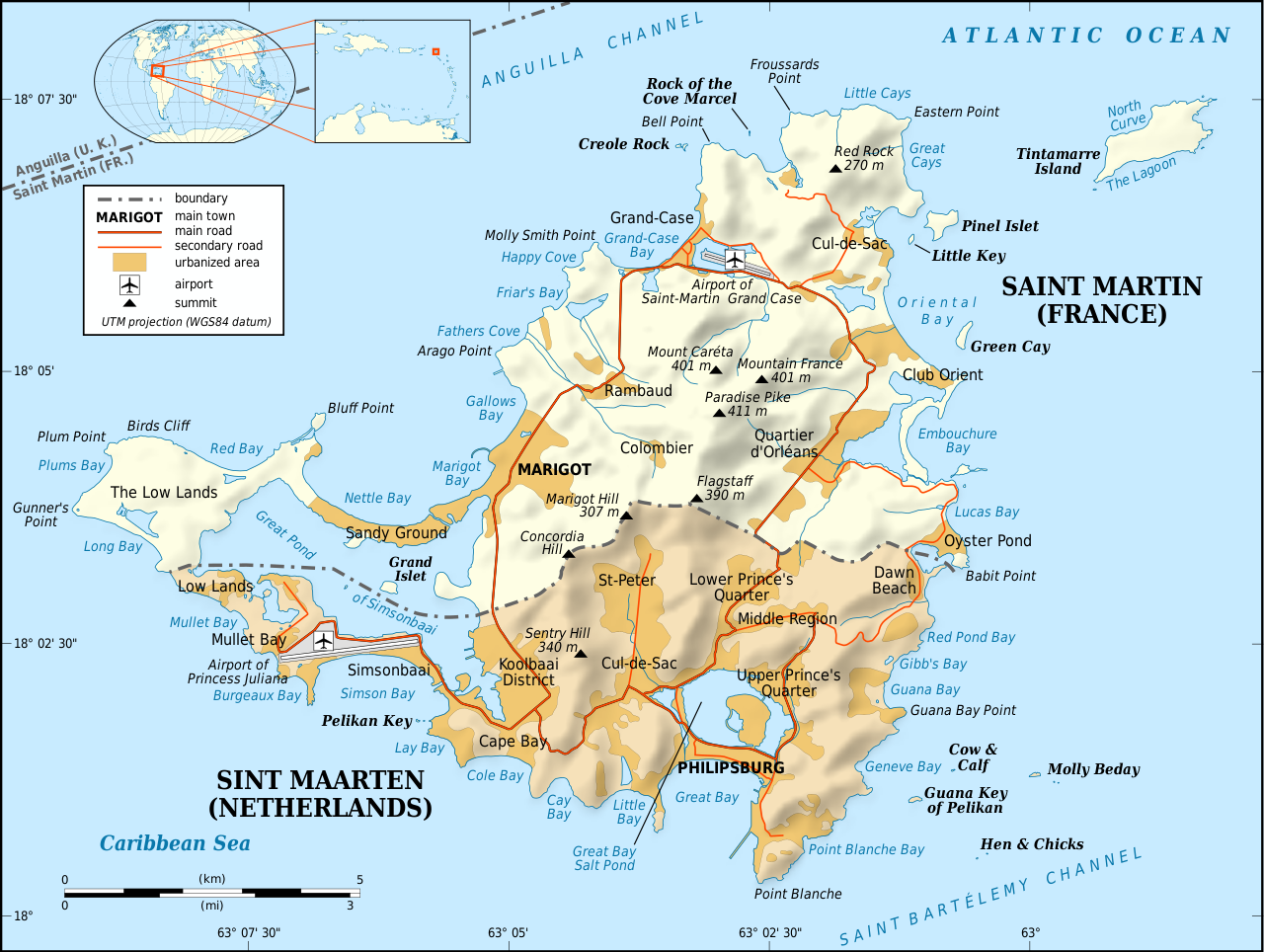
English: Map in English of the Caribbean island of Saint-Martin / Sint Maarten, divided between French and Dutch halves.
Note: the shaded relief is a raster image embedded in the SVG file. Français : Carte en anglais de l'île de Saint-Martin / Sint Maarten dans les Antilles, divisée en une partie française et une partie néerlandaise. Note : les ombres du relief sont une image bitmap embarquée dans le fichier SVG.
|
||
| Date | January 2009 (translation in May 2009) | ||
| Source |
Own work
|
||
| Author | Eric Gaba (Sting - fr:Sting) | ||
| Permission (Reusing this file) |
|
||
| Other versions |
[]
Same base map but smaller and without topography:
|


|
This SVG file contains embedded text that can be translated into your language, using any capable SVG editor, text editor or the SVG Translate tool. For more information see: About translating SVG files. |
Licensing
I, the copyright holder of this work, hereby publish it under the following licenses:
This file is licensed under the Creative Commons Attribution-Share Alike 3.0 Unported license.
- You are free:
- to share – to copy, distribute and transmit the work
- to remix – to adapt the work
- Under the following conditions:
- attribution – You must give appropriate credit, provide a link to the license, and indicate if changes were made. You may do so in any reasonable manner, but not in any way that suggests the licensor endorses you or your use.
- share alike – If you remix, transform, or build upon the material, you must distribute your contributions under the same or compatible license as the original.

|
Permission is granted to copy, distribute and/or modify this document under the terms of the GNU Free Documentation License, Version 1.2 or any later version published by the Free Software Foundation; with no Invariant Sections, no Front-Cover Texts, and no Back-Cover Texts. A copy of the license is included in the section entitled GNU Free Documentation License. |
You may select the license of your choice.
File history
Click on a date/time to view the file as it appeared at that time.
| Date/Time | Thumbnail | Dimensions | User | Comment | |
|---|---|---|---|---|---|
| current | 20:34, 5 May 2009 | | 1,102 × 830 (866 KB) | Sting | Spelling error correction |
| 19:13, 5 May 2009 |  | 1,102 × 830 (865 KB) | Sting | {{Location|18|04|00|N|63|03|30|W|scale:100000}} <br/> {{Information |Description={{en|Map in English of the Caribbean island of Saint-Martin / Sint Maarten, divided between French and Dutch halves.<br/> ''Note: the shaded relief is a |
File usage
The following page uses this file:
Global file usage
The following other wikis use this file:
- Usage on azb.wikipedia.org
- Usage on bs.wikipedia.org
- Usage on cs.wikipedia.org
- Usage on en.wikipedia.org
- Usage on es.wikipedia.org
- Usage on fa.wikipedia.org
- Usage on it.wikipedia.org
- Usage on ja.wikipedia.org
- Usage on sr.wikipedia.org
- Usage on zh.wikipedia.org