
File:Océan Atlantique.png
Océan_Atlantique.png (328 × 328 pixels, file size: 33 KB, MIME type: image/png)
|
|
This is a file from the Wikimedia Commons |
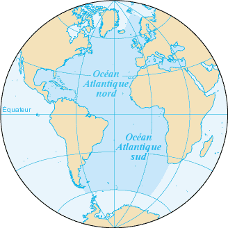
L'océan Atlantique, et ses mers dépendantes, en bleu foncé.
Fond de carte provenant de la CIA, francisé : https://www.cia.gov/library/publications/the-world-factbook/geos/zh.html archive copy at the Wayback Machine
 |
File:Océan Atlantique détourée.png
|
Carte cédée au domaine public.
| This work has been released into the public domain by its author, Bra. This applies worldwide. In some countries this may not be legally possible; if so: |
File history
Click on a date/time to view the file as it appeared at that time.
| Date/Time | Thumbnail | Dimensions | User | Comment | |
|---|---|---|---|---|---|
| current | 21:34, 3 July 2005 | | 328 × 328 (33 KB) | Idarvol | typo |
| 20:43, 3 June 2005 |  | 328 × 328 (33 KB) | Idarvol | L'Océan atlantique en bleu foncé. ''Fond de carte provenant de la CIA, francisé. ''Carte cédée au domaine public. {{PD-self|Bra}} |
File usage
The following page uses this file:
Global file usage
The following other wikis use this file:
- Usage on ady.wikipedia.org
- Usage on avk.wikipedia.org
- Usage on en.wiktionary.org
- Usage on fr.wikipedia.org
- Bahamas
- Islande
- Vannes
- Océan Atlantique
- Pas de Calais
- La Rochelle
- Sao Tomé-et-Principe
- Groenland
- Golfe de Guinée
- Plouguerneau
- Bénodet
- Clohars-Carnoët
- Combrit
- Fouesnant
- Île-Tudy
- La Forêt-Fouesnant
- Mer d'Irlande
- Mer des Caraïbes
- Golfe du Mexique
- Route du Rhum
- Açores
- Bermudes
- Saint-Pierre-et-Miquelon
- Îles Canaries
- Île de Man
- Gulf Stream
- Montserrat (Antilles)
- Asturies
- Galice
- Casablanca
- Canal de Panama
- Damgan
- Ambon (Morbihan)
- Arzon
- Fort Boyard (monument)
- Anguilla
- Provinces maritimes
- Phare de Cordouan
- Île de Ré
- Jutland
- Îles Malouines
- Saint-Sébastien (Espagne)
- Sercq
- Phare des Baleines
- Catégorie:Islande
- Îles du Salut
- Catégorie:Royaume-Uni
View more global usage of this file.