File:Newark buses.svg
Jump to navigation
Jump to search

Size of this PNG preview of this SVG file: 585 × 599 pixels. Other resolutions: 234 × 240 pixels | 469 × 480 pixels | 750 × 768 pixels | 1,000 × 1,024 pixels | 1,999 × 2,048 pixels | 4,452 × 4,560 pixels.
Original file (SVG file, nominally 4,452 × 4,560 pixels, file size: 1.24 MB)
|
|
This is a file from the Wikimedia Commons |
Summary
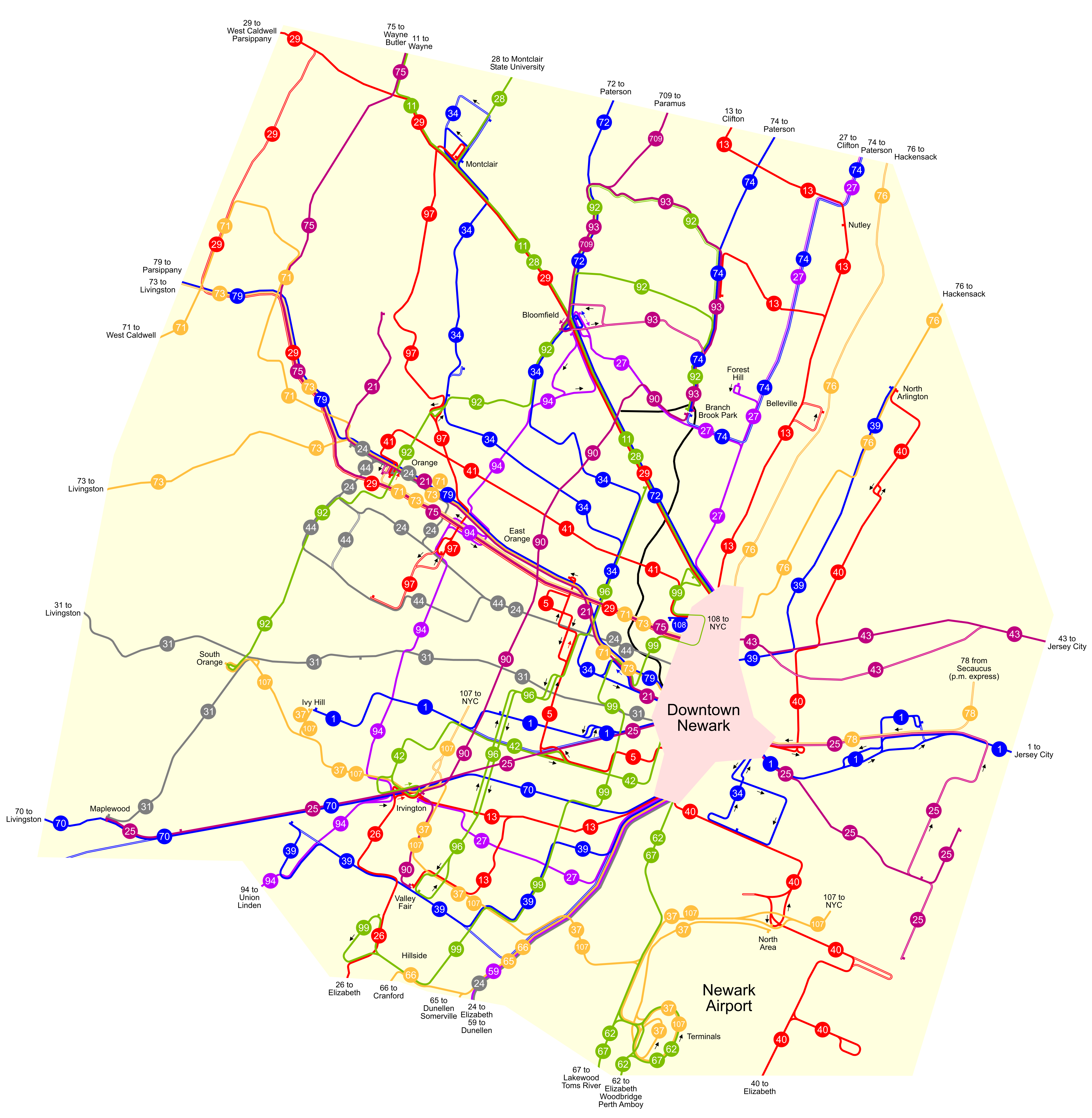
| Description | A map of the public bus routes in and around Newark, New Jersey, United States. The projection is Lambert conformal conic with a central meridian of 74.45 degrees west. The boundaries were arbitrarily chosen as places where the route density thins out. |
| Date | |
| Source | Own work |
| Author | User:NE2 |
Licensing
| I, the copyright holder of this work, release this work into the public domain. This applies worldwide. In some countries this may not be legally possible; if so: I grant anyone the right to use this work for any purpose, without any conditions, unless such conditions are required by law. |
File history
Click on a date/time to view the file as it appeared at that time.
| Date/Time | Thumbnail | Dimensions | User | Comment | |
|---|---|---|---|---|---|
| current | 21:35, 31 January 2007 | | 4,452 × 4,560 (1.24 MB) | NE2 | Added the 24, 31, and 44. |
| 18:54, 30 January 2007 |  | 4,452 × 4,560 (1.18 MB) | NE2 | De-emphasized the boundaries and enlarged it even more (3200%). | |
| 16:44, 30 January 2007 |  | 1,113 × 1,140 (1.17 MB) | NE2 | Enlarged by 800%. | |
| 16:33, 30 January 2007 |  | 139 × 143 (1.18 MB) | NE2 | This is the first draft of a map of the public bus routes in and around Newark, New Jersey, United States. You'll have to use an SVG viewer to see it full-size until I make a large raster image. The projection is Lambert conformal conic with a central me |
File usage
The following 2 pages use this file:
Global file usage
The following other wikis use this file:
- Usage on en.wikipedia.org