File:USA in The Man in the High Castle.png
Jump to navigation
Jump to search
Size of this preview: 800 × 471 pixels. Other resolutions: 320 × 189 pixels | 640 × 377 pixels | 1,024 × 603 pixels | 1,280 × 754 pixels | 2,352 × 1,386 pixels.
Original file (2,352 × 1,386 pixels, file size: 707 KB, MIME type: image/png)
|
|
This is a file from the Wikimedia Commons |

|
This map, as well as other fictitious maps, is fictitious or too incorrect (i.e. due to anachronism) to be used in real-life contexts (contemporary or historic). It may have some visual elements that are similar to official maps such as colors or certain layout features, but they are NOT official and don't have any official recognition. |
[[Category:]]
Summary
| Description |
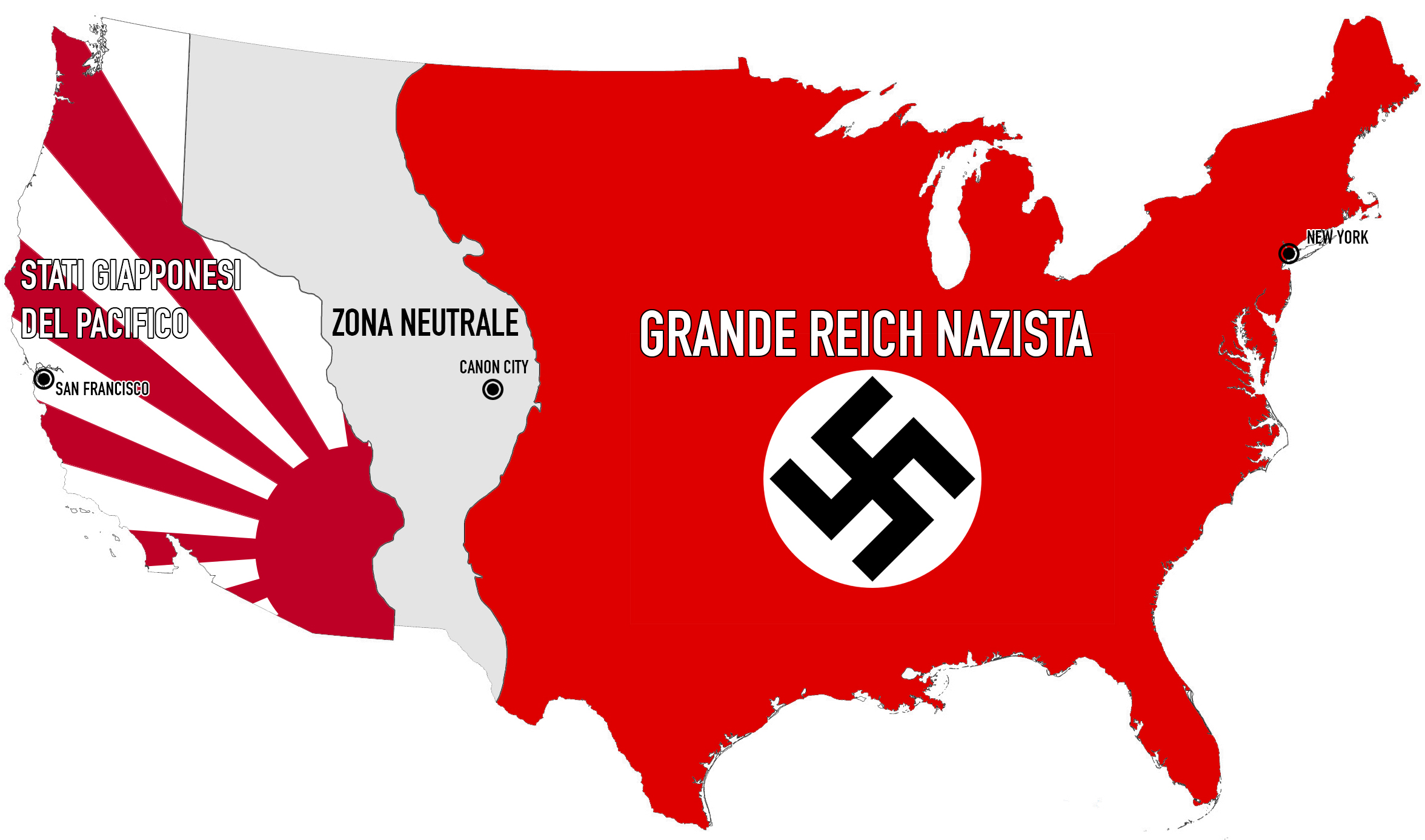
Italiano: Mappa degli USA spartiti tra Germania e Giappone come mostrato sulla serie TV "The Man in the High Castle". Sono anche evidenziate le città principali in cui si svolge la storia dell'episodio pilota. I nomi sono in Italiano. English: Map of the USA as seen in The Man in the High Castle tv series. Names are in Italian. |
| Date | |
| Source |
Own work (borders are based on a map shown in the pilot episode). |
| Author | RedFoxJinx |
| Permission (Reusing this file) |
Come autore rinuncio ai diritti sulla licenza e rendo l'immagine utilizzabile da tutti. |
| Other versions |
_map.png) |
Licensing
| This work has been released into the public domain by its author, RedFoxJinx at Italian Wikipedia. This applies worldwide. In some countries this may not be legally possible; if so: RedFoxJinx grants anyone the right to use this work for any purpose, without any conditions, unless such conditions are required by law. |
Original upload log
The original description page was here. All following user names refer to it.wikipedia.
File history
Click on a date/time to view the file as it appeared at that time.
| Date/Time | Thumbnail | Dimensions | User | Comment | |
|---|---|---|---|---|---|
| current | 19:31, 27 January 2015 | | 2,352 × 1,386 (707 KB) | RedFoxJinx | Nuova grafica e maggiore qualità della mappa. |
| 14:24, 26 January 2015 |  | 663 × 429 (853 KB) | Rupertsciamenna | == {{int:filedesc}} == {{Information |Description={{it|Mappa degli USA spartiti tra Germania e Giappone come mostrato sulla serie TV "The Man in the High Castle". Sono anche evidenziate le città principali in cui si svolge la storia dell'episodio pilo... |
File usage
The following 3 pages use this file:
Global file usage
The following other wikis use this file:
- Usage on it.wikipedia.org