
File:Tiryns, map of the palace and the surrounding fortifications.png

Size of this preview: 800 × 481 pixels. Other resolutions: 320 × 192 pixels | 640 × 385 pixels | 872 × 524 pixels.
Original file (872 × 524 pixels, file size: 663 KB, MIME type: image/png)
|
|
This is a file from the Wikimedia Commons |
Summary
| Description |
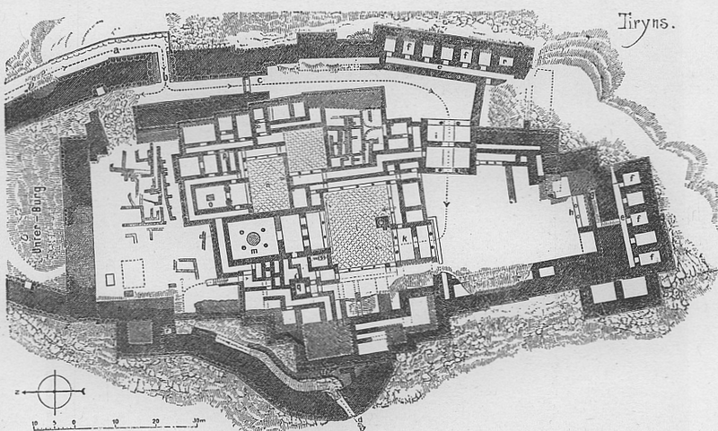
Deutsch: Plan der Burg von Tiryns English: Tiryns, Greece, map of palace Français : Tirynthe (Grèce), plan du palais, au sud de la citadelle. |
| Date | |
| Source | Selbst eingescannt aus Gustav Ebe: Kunstgeschichte des Altertums, Düsseldorf, 1895, S. 219. |
| Author | Gustav Ebe (1834–1916) |
Licensing
|
This work is in the public domain in its country of origin and other countries and areas where the copyright term is the author's life plus 70 years or fewer. | |
| This file has been identified as being free of known restrictions under copyright law, including all related and neighboring rights. | |
Original upload log
The original description page was here. All following user names refer to de.wikipedia.
- 2005-02-27 18:08 Albrecht Conz 872×524× (678954 bytes) Plan der Burg von Tiryns
File history
Click on a date/time to view the file as it appeared at that time.
| Date/Time | Thumbnail | Dimensions | User | Comment | |
|---|---|---|---|---|---|
| current | 11:27, 11 June 2005 | | 872 × 524 (663 KB) | Longbow4u | *'''Description''': Tiryns, Greece, map of castle *'''Author''': Albrecht Conz, scanned himself from Source, upload to German wikipedia by Albrecht Conz, 27.02.2005. *'''Source''': Gustav Ebe: |
File usage
The following page uses this file:
Global file usage
The following other wikis use this file:
- Usage on af.wikipedia.org
- Usage on ca.wikipedia.org
- Usage on en.wikipedia.org
- Usage on eo.wikipedia.org
- Usage on es.wikipedia.org
- Usage on eu.wikipedia.org
- Usage on fa.wikipedia.org
- Usage on fr.wikipedia.org
- Usage on hu.wikipedia.org
- Usage on it.wikipedia.org
- Usage on it.wikiversity.org
- Usage on no.wikipedia.org
- Usage on pms.wikipedia.org
- Usage on pt.wikipedia.org
- Usage on ru.wikipedia.org
- Usage on sh.wikipedia.org
- Usage on sl.wikipedia.org
- Usage on uk.wikipedia.org
- Usage on vi.wikipedia.org
- Usage on zh.wikipedia.org