File:Europe map Napoleon 1811.png
Jump to navigation
Jump to search
No higher resolution available.
Europe_map_Napoleon_1811.png (415 × 397 pixels, file size: 62 KB, MIME type: image/png)
|
|
This is a file from the Wikimedia Commons |


|
File:Europe map Napoleon 1811.svg is a vector version of this file. It should be used in place of this PNG file when not inferior.
File:Europe map Napoleon 1811.png → File:Europe map Napoleon 1811.svg
For more information, see Help:SVG. |
 |
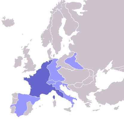
Map of the w:First French Empire and satellite states, with w:1811 borders. Created by User:OwenBlacker from Image:Europe blank map.png, therefore they are the source.
| I, the copyright holder of this work, release this work into the public domain. This applies worldwide. In some countries this may not be legally possible; if so: I grant anyone the right to use this work for any purpose, without any conditions, unless such conditions are required by law. |
derivative works
Derivative works of this file: Europe map Napoleon 1811.svg
File history
Click on a date/time to view the file as it appeared at that time.
| Date/Time | Thumbnail | Dimensions | User | Comment | |
|---|---|---|---|---|---|
| current | 08:06, 11 October 2022 | | 415 × 397 (62 KB) | Рагин1987 | Extended map |
| 13:01, 23 July 2020 |  | 415 × 422 (13 KB) | Leonel Sohns | Reverted to version as of 00:53, 16 October 2006 (UTC) | |
| 13:01, 23 July 2020 |  | 415 × 422 (11 KB) | Leonel Sohns | Recovered old version from archive.org | |
| 00:53, 16 October 2006 |  | 415 × 422 (13 KB) | Deltabeignet | Corrected status of Illyrian provinces. | |
| 00:51, 21 August 2005 |  | 415 × 422 (11 KB) | OwenBlacker | Map of the w:First French Empire and satellite states, with w:1811 borders. Created by User:OwenBlacker from Image:Europe blank map.png {{GFDL}} {{cc-by-sa-2.0-uk}} |
File usage
The following 3 pages use this file:
Global file usage
The following other wikis use this file:
- Usage on arz.wikipedia.org
- Usage on ast.wikipedia.org
- Usage on ba.wikipedia.org
- Usage on be.wikipedia.org
- Usage on bg.wikipedia.org
- Usage on bs.wikipedia.org
- Usage on ca.wikipedia.org
- Usage on cs.wikipedia.org
- Usage on cv.wikipedia.org
- Usage on de.wikibooks.org
- Usage on en.wikipedia.org
- Usage on eo.wikipedia.org
- Usage on fi.wikipedia.org
- Cisalppinen tasavalta
- Batavian tasavalta
- Hollannin kuningaskunta
- Napolin kuningaskunta
- Helvetian tasavalta
- Ligurian tasavalta
- Varsovan herttuakunta
- Malline:Napoleonin vasallit
- Etrurian kuningaskunta
- Alban tasavalta
- Reinin liitto (1806)
- Italian tasavalta (vasalli)
- Mainzin tasavalta
- Italian kuningaskunta (Napoleon)
- Cispadaaninen tasavalta
- Westfalenin kuningaskunta
- Illyrian provinssit
- Transpadaaninen tasavalta
- Usage on fr.wikipedia.org
- Usage on fy.wikipedia.org
- Usage on gl.wikipedia.org
- Usage on he.wikipedia.org
- Usage on hr.wikipedia.org
- Usage on hu.wikipedia.org
- Usage on io.wikipedia.org
- Usage on it.wikipedia.org
View more global usage of this file.