File:Oberaar and Unteraar Glaciers.jpg
Jump to navigation
Jump to search

Size of this preview: 800 × 600 pixels. Other resolutions: 320 × 240 pixels | 640 × 480 pixels | 1,024 × 768 pixels | 1,280 × 960 pixels | 2,048 × 1,536 pixels.
Original file (2,048 × 1,536 pixels, file size: 1.76 MB, MIME type: image/jpeg)
|
|
This is a file from the Wikimedia Commons |
Summary
| Description |
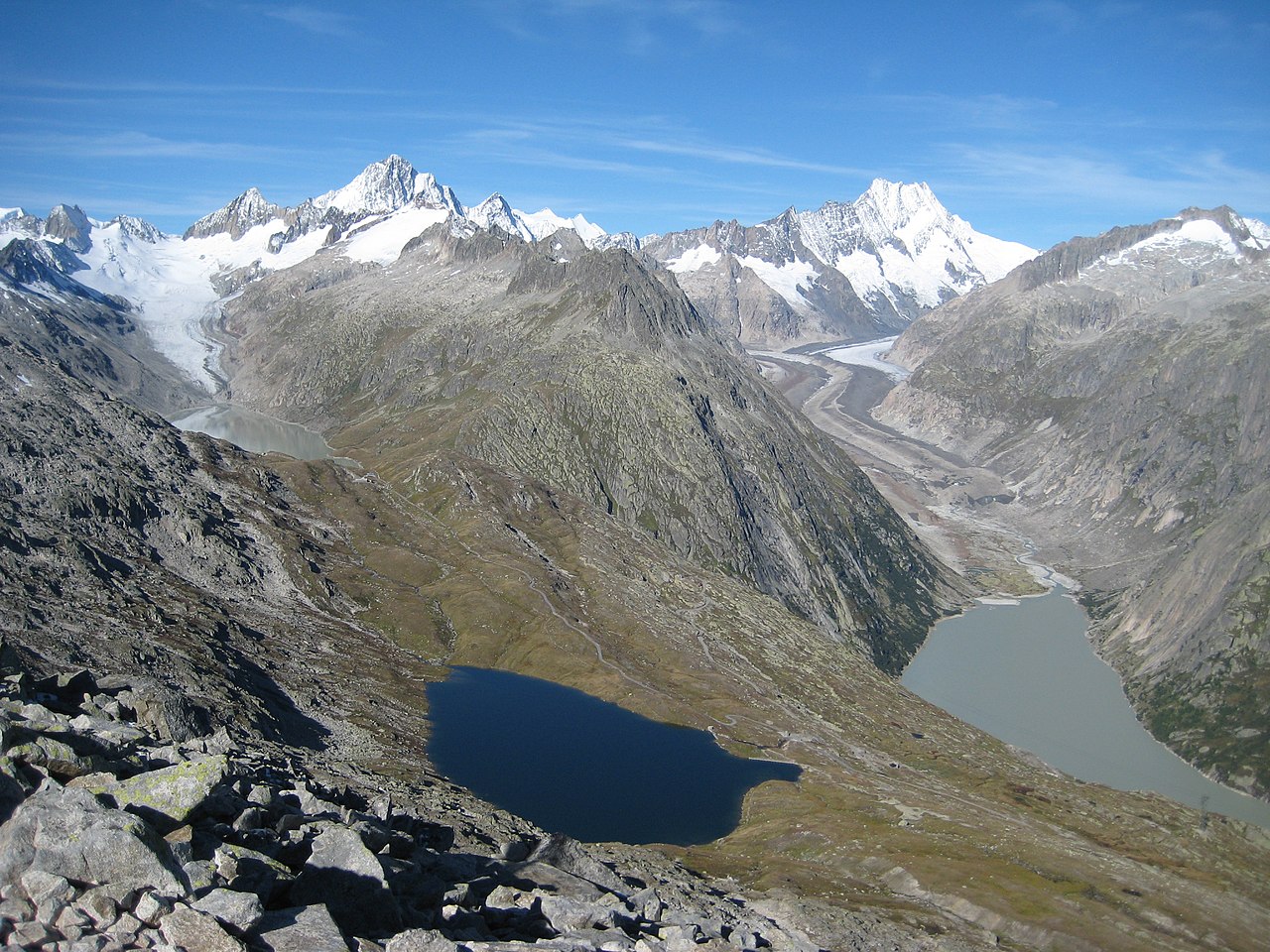
English: Glaciers and lakes of the Grimsel region (Bernese Alps, Switzerland) seen from Sidelhorn (2764 m): Oberaargletscher and Triebtenseewli on the left, Unteraargletscher and Grimselsee on the right. Among the summits are the Finsteraarhorn (4274 m), the Schreckhorn (4078 m) and the Lauteraarhorn (4042 m) |
| Date | |
| Source | Own work |
| Author | Markus Bernet |
| Camera location | | View this and other nearby images on: OpenStreetMap |
|---|
Licensing
I, the copyright holder of this work, hereby publish it under the following license:
This file is licensed under the Creative Commons Attribution 3.0 Unported license.
- You are free:
- to share – to copy, distribute and transmit the work
- to remix – to adapt the work
- Under the following conditions:
- attribution – You must give appropriate credit, provide a link to the license, and indicate if changes were made. You may do so in any reasonable manner, but not in any way that suggests the licensor endorses you or your use.
This image has been assessed using the Quality image guidelines and is considered a Quality image.
|
| Annotations | This image is annotated: View the annotations at Commons |
File history
Click on a date/time to view the file as it appeared at that time.
| Date/Time | Thumbnail | Dimensions | User | Comment | |
|---|---|---|---|---|---|
| current | 20:07, 10 December 2010 | | 2,048 × 1,536 (1.76 MB) | MRB | {{Information |Description={{en|1=Oberaar and Unteraar Glaciers seen from Sidelhorn (Canton of Valais, Switzerland)}} |Source={{own}} |Author=Markus Bernet |Date=2010-09-11 |Permission= |other_versions= }} {{coord|46|33|9.69|N|8|18|46.19|E|re |
File usage
The following 2 pages use this file:
Global file usage
The following other wikis use this file:
- Usage on arz.wikipedia.org
- Usage on cs.wikipedia.org
- Usage on de.wikipedia.org
- Usage on en.wikipedia.org
- Usage on he.wikipedia.org
- Usage on it.wikipedia.org
- Usage on ko.wikipedia.org
- Usage on nl.wikipedia.org
- Usage on nn.wikipedia.org
- Usage on pt.wikipedia.org
- Usage on sv.wikipedia.org
- Usage on uk.wikipedia.org
- Usage on www.wikidata.org