File:LocationSwedishEmpire.png
Jump to navigation
Jump to search
Size of this preview: 720 × 600 pixels. Other resolutions: 288 × 240 pixels | 576 × 480 pixels | 922 × 768 pixels | 1,200 × 1,000 pixels.
Original file (1,200 × 1,000 pixels, file size: 29 KB, MIME type: image/png)
|
|
This is a file from the Wikimedia Commons |
| Description |
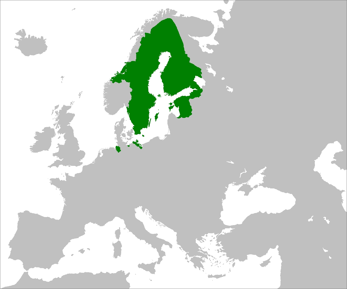
Bahasa Indonesia: Peta Imperium Swedia pada puncak terluasnya, pada tahun 1658. Wilayah-wilayah seberang laut tidak ditampilkan.
English: Map of the Swedish Empire at its greatest extent, in year 1658. Overseas possessions are not shown.
Latina: Imperium Suecicum anno 1658.
Svenska: Karta över det svenska stormaktsväldets största utsträckning, år 1658. Utomeuropeiska besittningar visas inte. |
||||||||
| Date | |||||||||
| Source | Self-made from File:Blank map europe.png; borders are based on File:Sweden 1658.jpg and File:Sweden in 1658.PNG. | ||||||||
| Author | Zakuragi | ||||||||
| Permission (Reusing this file) |
|
||||||||
| Other versions |
|


File history
Click on a date/time to view the file as it appeared at that time.
| Date/Time | Thumbnail | Dimensions | User | Comment | |
|---|---|---|---|---|---|
| current | 12:42, 6 July 2007 | | 1,200 × 1,000 (29 KB) | Tonym88~commonswiki | {{Information |Description= Map of the Swedish Empire at its greatest extent in the 1650s. |Source= Self-made from Image:Blank map europe.png; borders are based on Image:Sweden 1658.jpg and Image:Sweden in 1658.PNG. |Date= July 6, 2007 |Aut |
File usage
The following 3 pages use this file:
Global file usage
The following other wikis use this file:
- Usage on ar.wikipedia.org
- Usage on ast.wikipedia.org
- Usage on az.wikipedia.org
- Usage on ba.wikipedia.org
- Usage on be.wikipedia.org
- Usage on bg.wikipedia.org
- Usage on br.wikipedia.org
- Usage on ca.wikipedia.org
- Usage on cs.wikipedia.org
- Usage on da.wikipedia.org
- Usage on el.wikipedia.org
- Usage on en.wikipedia.org
- Usage on eo.wikipedia.org
- Usage on es.wikipedia.org
- Usage on eu.wikipedia.org
- Usage on fa.wikipedia.org
- Usage on fi.wikipedia.org
- Usage on fr.wikipedia.org
- Usage on gl.wikipedia.org
- Usage on he.wikipedia.org
- Usage on hr.wikipedia.org
- Usage on hy.wikipedia.org
- Usage on id.wikipedia.org
- Usage on it.wikipedia.org
- Usage on ja.wikipedia.org
- Usage on ko.wikipedia.org
- Usage on lt.wikipedia.org
- Usage on mr.wikipedia.org
- Usage on ms.wikipedia.org
- Usage on mt.wikipedia.org
- Usage on nl.wikipedia.org
- Usage on nn.wikipedia.org
- Usage on pl.wikipedia.org
- Usage on pt.wikipedia.org
- Usage on ro.wikipedia.org
View more global usage of this file.