File:Antarctica (7), Laubeuf Fjord, Webb Island.JPG
Jump to navigation
Jump to search

Size of this preview: 800 × 492 pixels. Other resolutions: 320 × 197 pixels | 640 × 394 pixels | 1,024 × 630 pixels | 1,280 × 787 pixels | 1,938 × 1,192 pixels.
Original file (1,938 × 1,192 pixels, file size: 523 KB, MIME type: image/jpeg)
|
|
This is a file from the Wikimedia Commons |
,_Laubeuf_Fjord,_Webb_Island.JPG)
Summary
| Description |
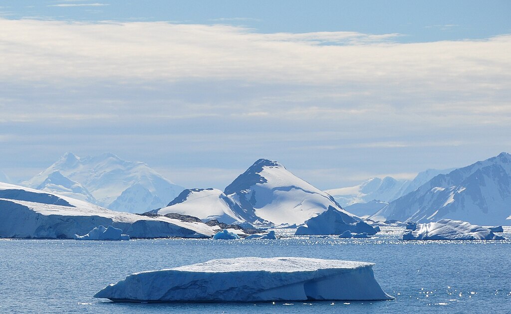
English: View toward the NNE from Rothera Research Station (on Adelaide Island) over Laubeuf Fjord. At the centre is Webb Island. On the left are some ice cliffs from the Wormald Ice Piedmont (also on Adelaide Island). The distant mountain behind the ice piedmont is probably the Mount St. Louis Massif (1280 m) on Arrowsmith Peninsula on the Antarctic mainland, 53 km from Rothera. The somewhat darker mountains on the right are on Wyatt Island in Laubeuf Fjord. |
| Date | |
| Source | Own work |
| Author | Vincent van Zeijst |
•
| Camera location | | View this and other nearby images on: OpenStreetMap |
|---|
,_Laubeuf_Fjord,_Webb_Island.JPG¶ms=-67.568767_N_-068.125147_E_globe:Earth_type:camera_heading:22.50&language=en)
Licensing
I, the copyright holder of this work, hereby publish it under the following license:
This file is licensed under the Creative Commons Attribution-Share Alike 3.0 Unported license.
- You are free:
- to share – to copy, distribute and transmit the work
- to remix – to adapt the work
- Under the following conditions:
- attribution – You must give appropriate credit, provide a link to the license, and indicate if changes were made. You may do so in any reasonable manner, but not in any way that suggests the licensor endorses you or your use.
- share alike – If you remix, transform, or build upon the material, you must distribute your contributions under the same or compatible license as the original.
File history
Click on a date/time to view the file as it appeared at that time.
| Date/Time | Thumbnail | Dimensions | User | Comment | |
|---|---|---|---|---|---|
| current | 20:13, 18 March 2011 | | 1,938 × 1,192 (523 KB) | Loranchet | {{Information |Description ={{en|1=View toward the NNE from Rothera Research Station (on Adelaide Island) over Laubeuf Fjord. At the centre is Webb Island. On the left are some ice cliffs from the Wormald Ice Piedmont (also on Adelaide Island). The dis |
File usage
The following page uses this file:
Global file usage
The following other wikis use this file:
- Usage on azb.wikipedia.org
- Usage on es.wikipedia.org
- Usage on es.wikinews.org
- Usage on it.wikipedia.org
- Usage on no.wikipedia.org
- Usage on pt.wikipedia.org
- Usage on www.wikidata.org
,_Laubeuf_Fjord,_Webb_Island.JPG)