File:Nuclear waste locations USA.jpg
Jump to navigation
Jump to search
Size of this preview: 800 × 551 pixels. Other resolutions: 320 × 220 pixels | 640 × 441 pixels | 1,024 × 705 pixels | 1,280 × 882 pixels | 1,909 × 1,315 pixels.
Original file (1,909 × 1,315 pixels, file size: 357 KB, MIME type: image/jpeg)
|
|
This is a file from the Wikimedia Commons |
Summary
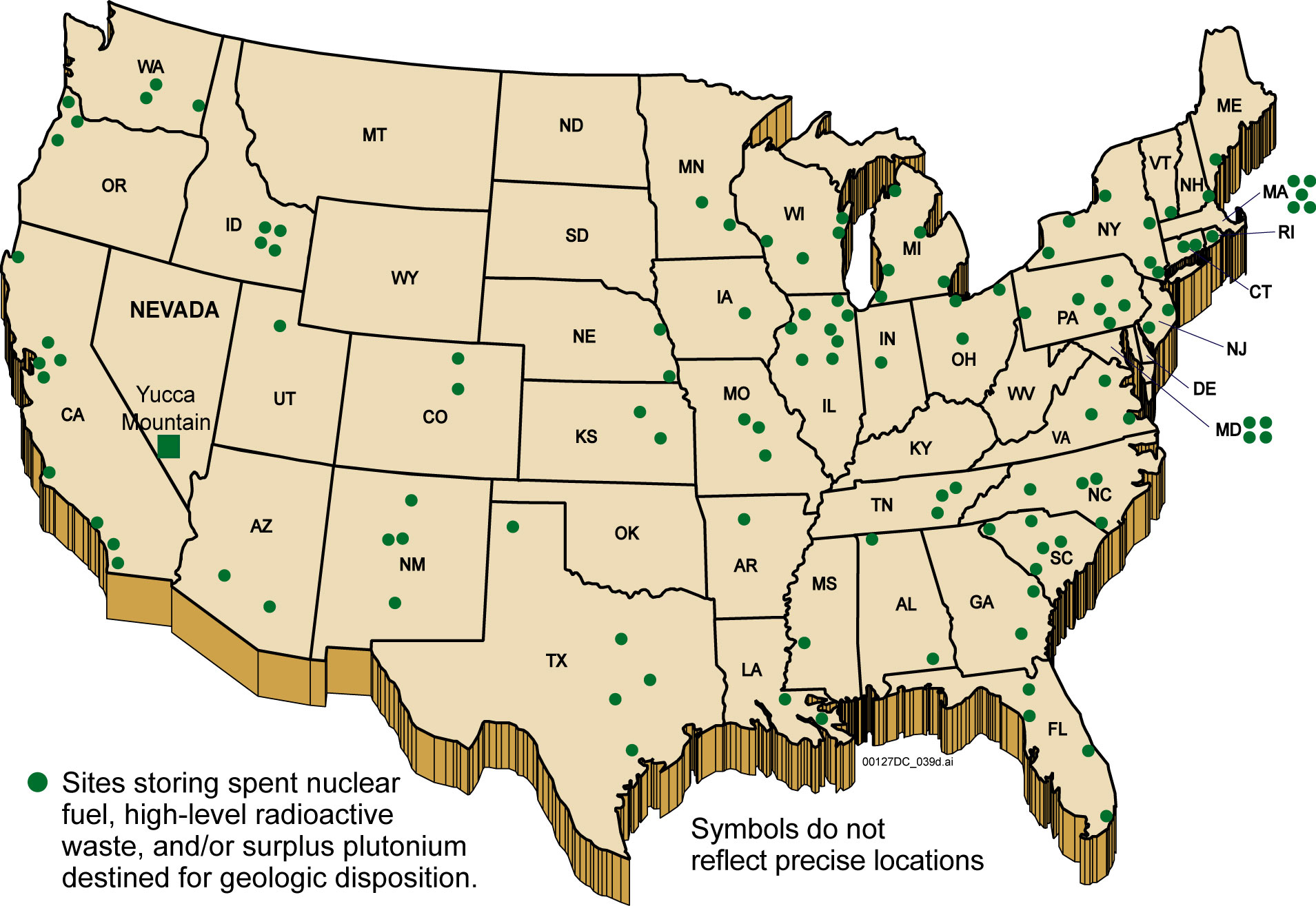
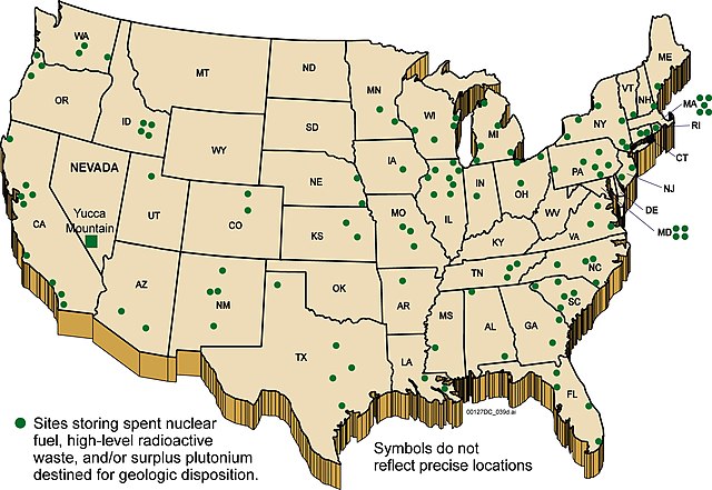
Map of current nuclear waste storage locations in the United States. Positions are approximate.

|
This economic map image could be re-created using vector graphics as an SVG file. This has several advantages; see Commons:Media for cleanup for more information. If an SVG form of this image is available, please upload it and afterwards replace this template with
{{vector version available|new image name}}.
It is recommended to name the SVG file “Nuclear waste locations USA.svg”—then the template Vector version available (or Vva) does not need the new image name parameter. |


Licensing
- Source: http://ocrwm.doe.gov/info_library/newsroom/photos/photos_graphics.shtml archive copy at the Wayback Machine
| This image is a work of a United States Department of Energy (or predecessor organization) employee, taken or made as part of that person's official duties. As a work of the U.S. federal government, the image is in the public domain.
Please note that national laboratories operate under varying licences and some are not free. Check the site policies of any national lab before crediting it with this tag.
|

|
File history
Click on a date/time to view the file as it appeared at that time.
| Date/Time | Thumbnail | Dimensions | User | Comment | |
|---|---|---|---|---|---|
| current | 18:44, 6 August 2006 | | 1,909 × 1,315 (357 KB) | Fastfission~commonswiki | Map of current nuclear waste storage locations in the United States. Positions are approximate. ==License== *Source: http://ocrwm.doe.gov/info_library/newsroom/photos/photos_graphics.shtml {{PD-USGov-DOE}} Category:Nuclear waste |
File usage
The following page uses this file:
Global file usage
The following other wikis use this file:
- Usage on cv.wikipedia.org
- Usage on en.wikipedia.org
- Usage on fa.wikipedia.org
- Usage on fr.wikipedia.org
- Usage on ru.wikipedia.org
- Usage on zh.wikipedia.org